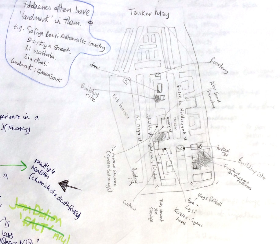
 I mapped as I walked, marking the building sites, businesses and people I met. The thing about Abu Dhabi addresses is that names can be a bit fluid. Some roads have three names, and a number, and these change now and again. It's on a grid, so you won't get lost, but you usually have to wayfind by landmarks - especially with packages and cabs. Memory maps are important here, addresses can be described by things which don't exist any more. The Tanker Mai area to the east of the city is named for the water tank which used to stand here, and often an address will finish with a landmark, 'behind the pink building, or 'by the green souk'' for example.
Airport Road cuts through the city. As far as I can tell, It's also called,'Sultan Bin Zayed the first', 'East Road, and 4th Street. The 'East coast road', or 'Eastern ring road', is also called, Sheik Zayed Bin Sultan Street (don't confuse it with 'Sultan Bin Zayed"),'8th Street, or 'Al Salam street' 'Al Bateen street' is now 'Sultan Bin Zayed Street' (don't confuse it with the others), and 32nd Street. It's actually quite an organic way to locate places and makes for a lot of conversations on the way. See http://www.dubaifaqs.com/street-names-abu-dhabi.php for more information Comments are closed.
|
Archives
August 2020
Categories
All
|
 RSS Feed